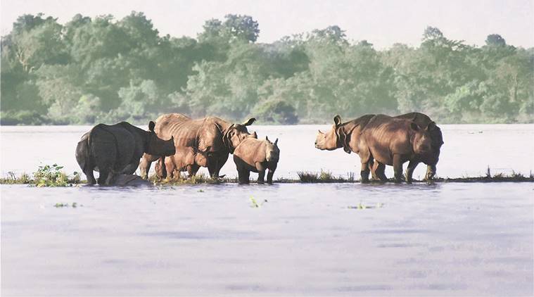
Assam is one of the worst victim of floods in India. The every monsoon causes recurring floods and flood-like situations across Assam, killing scores of people and leaving several hundred homeless.
How vulnerable is Assam?
- According to the National Flood Commission of India (NFCI), about 40% of the state’s area is flood-prone.
- The floods caused by the release of water in the Brahmaputra’s upstream have become a common monsoon bane in Assam.
- Human-made factors have compounded this annual problem.
- After the North East Electric Power Corporation opened up its dams to release water from the Ranganadi Hydro-electric Project, the problems have compounded.
- The floods are also caused by the runoff of heavy rainfall during the monsoon and by the high sediment loads from upper watersheds that are geologically unstable and degraded.
Why the problem still persists?
- Assam’s policymakers are well aware of the problems emanating from the Brahmaputra’s upstream.
- However, the authorities have not yet come together to resolve the issue.
- Even within Assam, agencies which should be working together to keep the floods in check, have operated along different lines.
- While the state’s disaster management authority has correctly identified the geological instability, Assam’s water resource department continues to dwell on the discredited system of embankments.
- But, the floods in the past have shown that when the Brahmaputra swells up, it puts pressure on the embankments, thus causing breaches.
- Also, studies have also shown that the Brahmaputra changes course frequently.
- It is virtually impossible to contain the river within the embankments.
- The solution lies in dialogue between upper and lower riparian states. In this case, it is Arunachal Pradesh and Assam.
- The Brahmaputra is among the better studied of the country’s rivers, so, it is high time to put the research to practice.
What are the major causes of flood and soil erosion?
Natural causes:Geology and Geomorphology of the region
i) Physiographic condition in the valley
ii) Seismic activity
iii) Excessive rainfall
Man-made causes:
i) Drainage congestion due to man-made embankments
ii) Human encroachment of riverine areas
iii) The narrow and elongated U-shaped valley opens itself wider towards the Bay of Bengal for monsoon flow. The average width of the valley is 80-90 km while the average width of the river is 6-10 km. The natural course of the river flows from high elevation to a steep falling elevation once the river enters India.
- Between Brahmaputra valley and the North East Hills, the average rainfall during monsoons varies between 2,480 mm to 6,350 mm, respectively. Due to excess rainfall, water gushes towards lower parts of Assam, eating away the relatively soft edges of land.
- The physiology of the region is still young and the lesser Himalaya regions are still in the process of forming. The soft rocks, in the absence of green top cover, easily gives way to gushing waters.
- The problem is further compounded by human settlements along the river and its various tributaries, thereby restricting the flow to follow its natural spread in times of flood.
- The building of embankments along the Brahmaputra and its tributaries has only added to flooding waters breaking embankments.
- Drainage congestion due to building of railway bridges, roads and culverts have restricted the natural flow of waters, forcing it to back flow and break embankments in vulnerable areas.
- Lack of countryside drainage through construction of sluices at critical points have also added to drainage congestion.
What is National Flood Control Programme?
- The National Flood Control Programme was launched in 1954 for the first time, in the country.
- During the period of two decades, considerable experience had also been gained in planning, implementation and performance of the flood protection and control measures. It then required detailed study of various problems concerned with flood control measures and aspects like soil conservation and afforestation.
- Government, therefore, decided to set up the Rashtriya Barh Ayog (National Flood Commission of India) in 1976 to evolve a coordinated, integrated and scientific approach to the flood control problems
- And to draw out a national plan fixing priorities for implementation in the future.
What is the solution?
- There has been excess emphasis for investing in structural solutions like building of embankments and little focus on natural flood control mechanisms based on local topography.
- Till date, close to 5,000 km of embankments have been built at various points along the Brahmaputra and its tributaries. This has resulted in restricting the flow of river during peak monsoons and caused increased pressure on embankments in vulnerable areas leading to embankments being breached at several places.
- While people living along the rivers have traditionally developed their own means of surviving the raging waters, those living around the safer areas next to embankments have often been caught by surprise.
- Training local population on how to cope with this, better early warning system, preparedness by authorities with adequate infrastructure
- Local solution like constructing Bamboo Porcupines is a sustainable strategy.
- It is time for the government and related agencies to review the existing policy of building embankments without considering natural outlets for excess water to flow. This will work best when local people are made stakeholders in finding localized solutions based on local topography.
- During floods, lack of clean drinking water is the biggest problem. Today, thanks to innovative science, there are several low-cost water filtration and purification technologies available, which people can deploy in times of floods. The government must spend more in creating awareness and making the same available at subsidized cost to people.
The solution to this recurring problem lies concrete attention and action of the both central and state govts. All the stakeholders including the public must cooperate to weed out this menace.