Glaciers in Himachal
A glacier is a naturally moving body of large dimensions made up of crystalline ice formed on the earth's surface as a result of accumulation of snow. It is estimated that glaciers cover about 16.3 million sq. km. of our globe. Majority of glaciers exist in the Himalayas. Out of these large numbers are found in the Main Himalayan range while others occur on offshoot ranges such as the Pir Panjal and Dhauladhar.The effect of aspect on the glaciation in a particular region is mainly due to differences in the solar radiation received by them. South facing slopes have a relatively less ice cover. In the same manner areas receiving more annual precipitation in the form of snow are heavily glaciated.
Himalayan snow, ice and glaciers form the tallest water tower of the world and are the sources of abundant fresh water resources. Ancient human civilisations flourished around them. These high mountain areas are susceptible to water related disasters due to increased orographic precipitation and steep and unstable slopes. Increasing human and animal population and economic transformation have exerted considerable pressure on the natural resources of the region.
A sufficient area of the high mountain system lie higher than the snow line (isotherm 0°C) and in this area snow falls round the year. In these mountains, it is estimated that 10 to 20% of the total surface area is covered by glaciers while an additional area ranging from 30 to 40% is overlying by seasonal snow cover. The maximum extent of Himalayan snow cover could be more than 1.5 x 10⁶ km2 while the glacier cover is around 10,000 Km2.
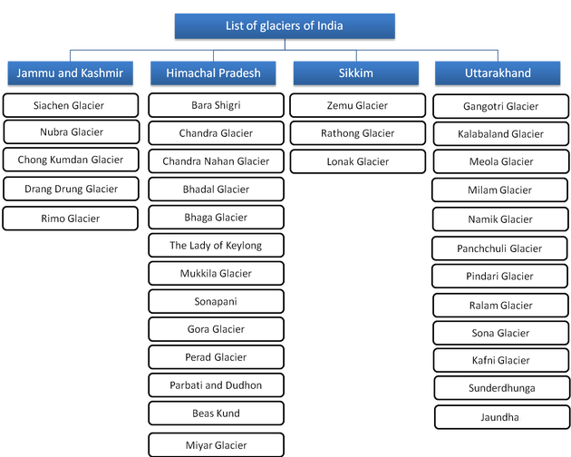
1. Bara shigri: The Bara Shigri glacier is the largest glacier in the Chandra Valley of Lahaul and difficult to be trekked. It is tenanted in a cirque on the middle slopes of the main Himalayan range. The Bara Shigri glacier attracted much attention for many years because of the valuable antimony deposits found there. The glacier was first surveyed in 1906 by H. Walker and E.H. Pascoe of the Geologiaal Survey of India. Daring 1955 the Geological Survey of India sponsored an expedition to this glacier as part of the Indian programme for the International Geophysical Year 1956-57, when a number of Himalayan glaciers were examined and their snout position fixed.
The Bara Shigri glacier, whose name signifies ’boulder-covered-ice’, flows northwards and debouches into the Chandra river where its southerly course is deflected westwards, close to the Spiti border. The glacier is above 3,950 m altitude and extends beyond 4,570 m, a 11 km length of which has been recently surveyed and mapped. The glacier is so heavily covered with surface moraine that ice is not visible for long stretches except along the crevices and in the ablation areas.
Across the Bara Shigri is another glacier known as Chhota Shigri. It is a comparatively smaller glacier and does not reach down to the bed of the river, but it is most steep and slippery, difficult to cross.
2. Chandra glacier: This glacier is responsible for forming Chandertal lake and has originally separated from Bara Shigri glacier. It is tenanted in a Cirque of the towering peak. It gives water to form Chandra river which joins Bhaga to form Chenab. Thick deposits of moraines are found in this tract. It is approached via Khoksar.
3. The lady of keylong: This glacier is situated at an altitude of about 6061 met. which can be seen from Keylong and is popular among visitors. It is interesting to note that it was named by Lady Elashainghday about a century ago during British Raj. Although it is always snow covered, but in the middle of it there is seen a dark bare patch that looks like the figure of a woman walking with a load on her back. Geological Survey of India has named this spot "The Lady of Keylong".
4. Mukila glacier: The Mukila glacier of Bhaga valley is situated at the height of about 6478 m.
5. Bhaga glacier: This glacier is tenanted in an amphitheater in Lahaul area of the main Himalayan range. It is a source of Bhaga river and later merges with Chandra forms Chenab afterTandi.
6.Sonapani glacier: The Sonapani glacier was surveyed by Walker and Pascoe in A.D. 1906. It is only about five and half km from the confluence of Kulti Nala and was also surveyed by K u r i o n and Munshi from the geological Survey of India in the year A.D. 1957. The desiccated glacier lake and the old terminal moraine are visible from the Rohtang Pass. The desiccated lake, about 2.5 km in length, is a narrow meandering plain following the contours of bounding slopes and consists of such fluvio-glacial deposits as mud, fine sand, pebbles and angular gravels, through which the glacier stream runs. The glacier is about 11 km long. An ice-cliff forms the snout which is mostly covered by stone, and the stream issues from an ice cave situated towards the western limb of the curved ice-cliff. To the south of the snout, and near to it, is a small terminal moraine. A large terminal moraine used to hold up the waters of the old lake. Three more old terminal moraines are cut through by the Sonapani stream after its escape from the lake-bed.
7. Perad glacier: The Perad glacier is a small easily accessible near Putiruni, which in local dialect means broken rock, that has a nice cave too. It is a small one and is easily accessible being within one kilometre of Putiruni. There is a well marked ice-cave and the glacier stream runs between two large lateral moraines.
8. Dudhon and parbti glacier: Dudhon and Parbati glaciers impart water for Parbati stream each are about 15 km of length.
9. Beads kund glacier: This glacier is located on the South-facing slopes of the towering Pir Panjal range near the conspicuous Rohtang Pass in Manali region of Himachal Pradesh. It drainages the Beas river.
10. Bhadal glacier: It is located on the South-Western slopes of the Pir Panjal range in the Bara Banghal region of Kangra district in Himachal Pradesh.
11. Chandra nahan glacier: This glacier is located in a small amphitheater on the South-Eastern slopes of the main Himalayan range in the area North-West of Rohru in Himachal Pradesh.
12. Gangstang Glacier :The Gangstang glacier situated at the western border of the Lahaul region at an altitude of about 5,480 m streaming into Shahsha nullah which joins the Chandrabhaga river at about 13 km to the south.
These are the most important glaciers of the Himachal Pradesh which not only provides water to drink and electricity but also gives an assurance tha our border areas are naturally protected by them.